Exploring Eswatini and the Barberton Geotrail
I’ve been to Swaziland many times. During my early years in South Africa, Swaziland felt almost like a second home to me. But I hadn’t been to Swaziland since it was renamed Eswatini in 2018, and that was a situation that needed to be rectified. So when I planned our holiday to Mpumalanga in December, I booked a cross-border hop to Eswatini to stay a couple of days at the Phophonyane Falls Ecolodge.

Phophonyane, which is known for its impressive waterfall, is a private nature reserve in the northern part of Eswatini, not far from the town of Piggs Peak. We entered Eswatini through the Jeppe’s Reef border crossing, spent three days at Phophonyane, then drove out through the Bulembu border crossing and briefly checked out the Barberton Makhonjwa Geotrail before heading to Kaapsehoop for our friend Julia’s wedding.
Three Days at Phophonyane Falls
Although Phophonyane has been around for decades, I had never heard of the lodge until last year, when I happened to read a travel article that briefly mentioned it. I was excited to check out a new corner of this tiny country.

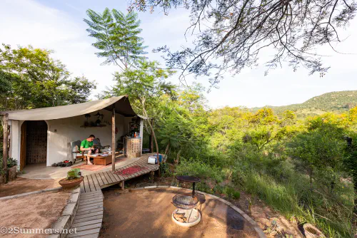
We also wanted to stay at Phophonyane because of its unique accommodation options, one of which is a traditional beehive dwelling. Beehive huts were, and still are, used by both Zulu and Swati people (as well as people all over the world) and we were keen to stay in one.


The grounds of the lodge are lovely and there is a nice swimming pool, which we never got around to using due to persistent rain. The restaurant is also very pleasant, but the food is just okay and on the expensive side, in my opinion – I would describe the prices as geared toward European/American guests rather than South African guests. If I were to ever go back to Phophonyane, I would choose their self-catering cottage.


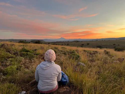
Phophonyane’s main draw is its indigenous forest, with the waterfall as the central feature. It rained A LOT during the three days we were there, but we loved hiking the nature reserve’s network of trails in between showers.


Crossing the Border and the Barberton Geotrail
Phophonyane is very close to the Bulembu border crossing (it’s called Josefdal on the South African side), which is a dirt road best suited to 4x4s. Greylene navigated it with ease.


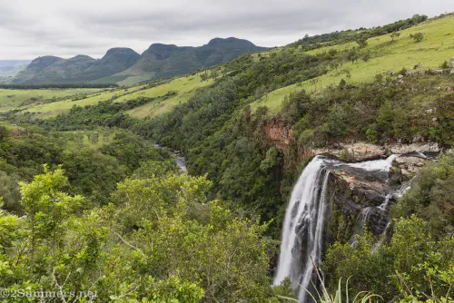
After crossing over to the South African side, we passed through the Barberton Makhonjwa Geotrail. This 37-kilometer stretch of road between Barberton (read this old post about Barberton, which is still much the same 13 years later) and the Eswatini border is a World Heritage Site, both because of the spectacular mountain views and because the rocks in these mountains are more the three billion years old.

I’ve driven this route several times, both before and after the Geotrail was officially opened in 2014. Unfortunately, most of placards and displays along the Geotrail have badly faded and peeled, so you can no longer read them easily. If you’re seriously into geology, I recommend printing out information about the Geotrail for yourself before going. Either way, the views along the Geotrail are spectacular – especially in summer when the mountains are neon green.


You don’t need a 4x4 to explore the Barberton Geotrail – the road is fully paved on the South African side. You’ll just have to turn around when you reach the Eswatini border.
At long last, the final post about my holiday trip to Mpumalanga and Eswatini is complete. I have three more 2025 road trips to catch you up on now! If you haven’t already, please subscribe to 2Summers via email so you don’t miss any of the posts.
Comments
Makes me wanna go too! Those are just stunning views.
And they are definitely better in person
Love the waterfall selfie.
Thanks!
SO lush-looking. And the beehive architecture was lovely to see–fantastic photos, as usual.
Thanks. It’s been so long since we were there – it almost doesn’t look like a real place to me anymore.